ESAM-M · Marbella Submarine Reef Station
Observe, monitor and study
Marbella's underwater coastline.
A modular, reversible submarine infrastructure with a low physical footprint, designed to gather environmental data, monitor the seabed and watch for invasive species. Privately funded, at no cost to the municipality.
Conceptual representation. Preliminary stage, prior to formal administrative application.
What ESAM-M is
An observation station, not an occupation of the coast.
ESAM-M is conceived as a modular submarine station, made up initially of up to ten independent modules, placed on the seabed in a reversible and fully removable way. Its role is the continuous monitoring of the environment through visual observation, water and sediment control, sensors and inspection by diving or ROV.
The associated wine activity is complementary: it makes it possible to economically sustain the infrastructure, environmental surveillance and final removal, without passing those costs on to citizens.
- 10independent modules
- 40 m²direct physical footprint
- 112 m²estimated functional area
- 500 m²maximum concession polygon
Honest from the outset
What it is — and what it is not.
Is a knowledge infrastructure
- An environmental monitoring, surveillance and study station.
- A reversible installation with a low physical footprint.
- Verifiable data made available to the Authorities.
- A privately-led blue-economy model.
Is not an exploitation of the coast
- Not a winery or a submarine tourist facility.
- Not a recreational diving spot open to the public.
- No dredging, excavation, concreting or dumping.
- Not a permanent work, and it does not replace public authority.
The project makes no upfront claims of ecological benefits. Any possible effect on colonisation or biodiversity will be measured, documented and verified through monitoring and comparison over time.
Environmental purpose
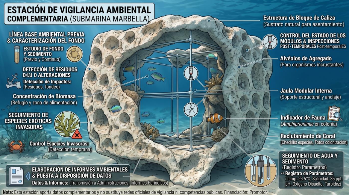
Providing a complementary layer of environmental knowledge.
The station does not replace official surveillance networks: it contributes additional data, funded by the promoter, on a specific point of the coastline.
- Prior environmental baseline and seabed characterisation
- Water and sediment monitoring (temperature, salinity, pH, O₂, turbidity)
- Visual monitoring of fauna and colonisation
- Module condition control and post-storm inspections
- Detection of waste or alterations
- Periodic environmental reports made available to the Authorities
Planned layout
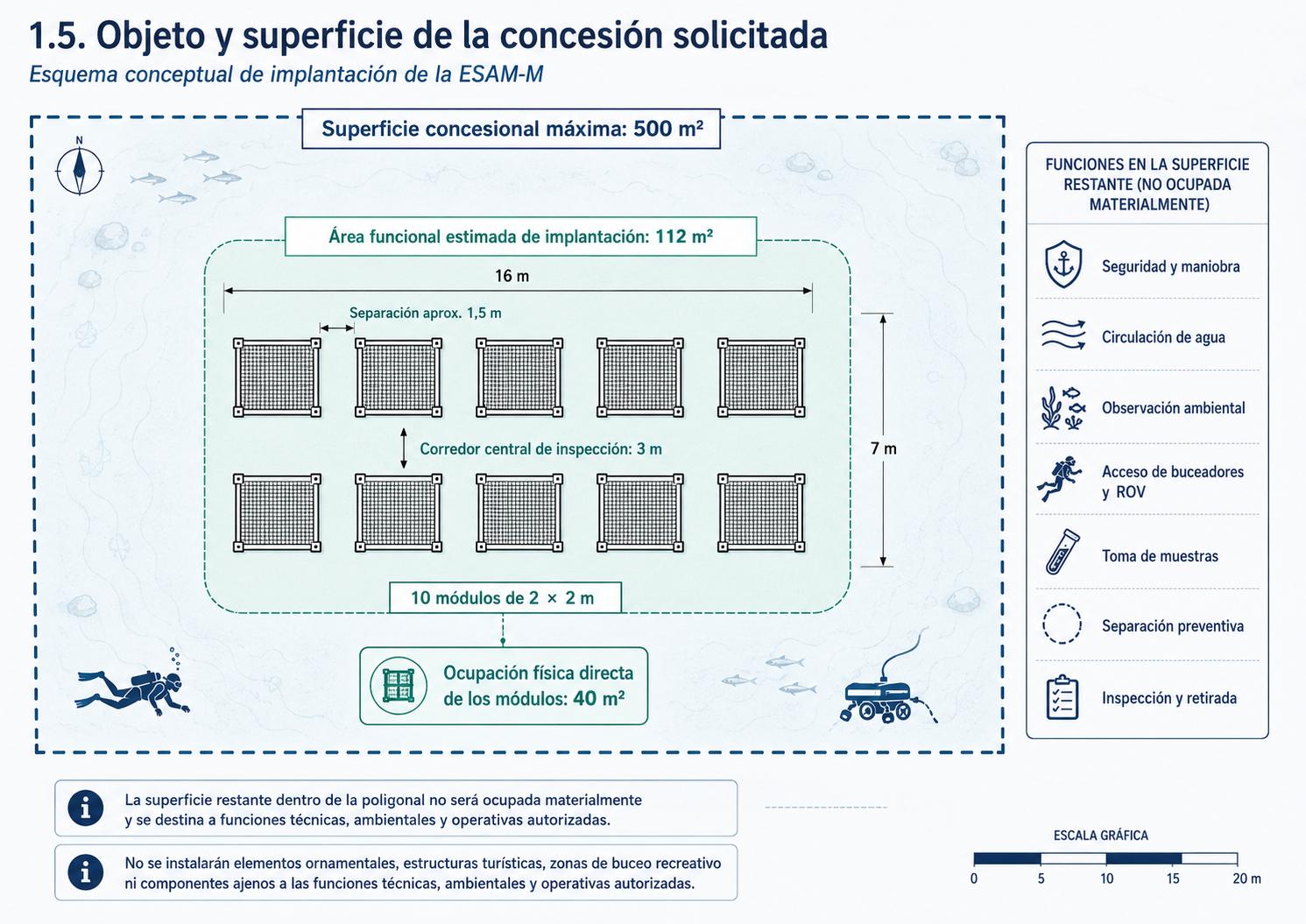
500 m² requested. 40 m² actually occupied.
Ten 2×2 m modules arranged in two rows of five, with a central technical corridor for inspection, water circulation, maintenance, sampling and removal.
Most of the polygon is not materially occupied: it acts as a safety, manoeuvring, observation and preventive-separation zone with respect to other uses.
The final location is not yet fixed. It will be determined through bathymetry, geo-referenced underwater video, a bionomic study and compatibility analysis with seagrass, navigation, fishing and anchoring.
Materials and reef design
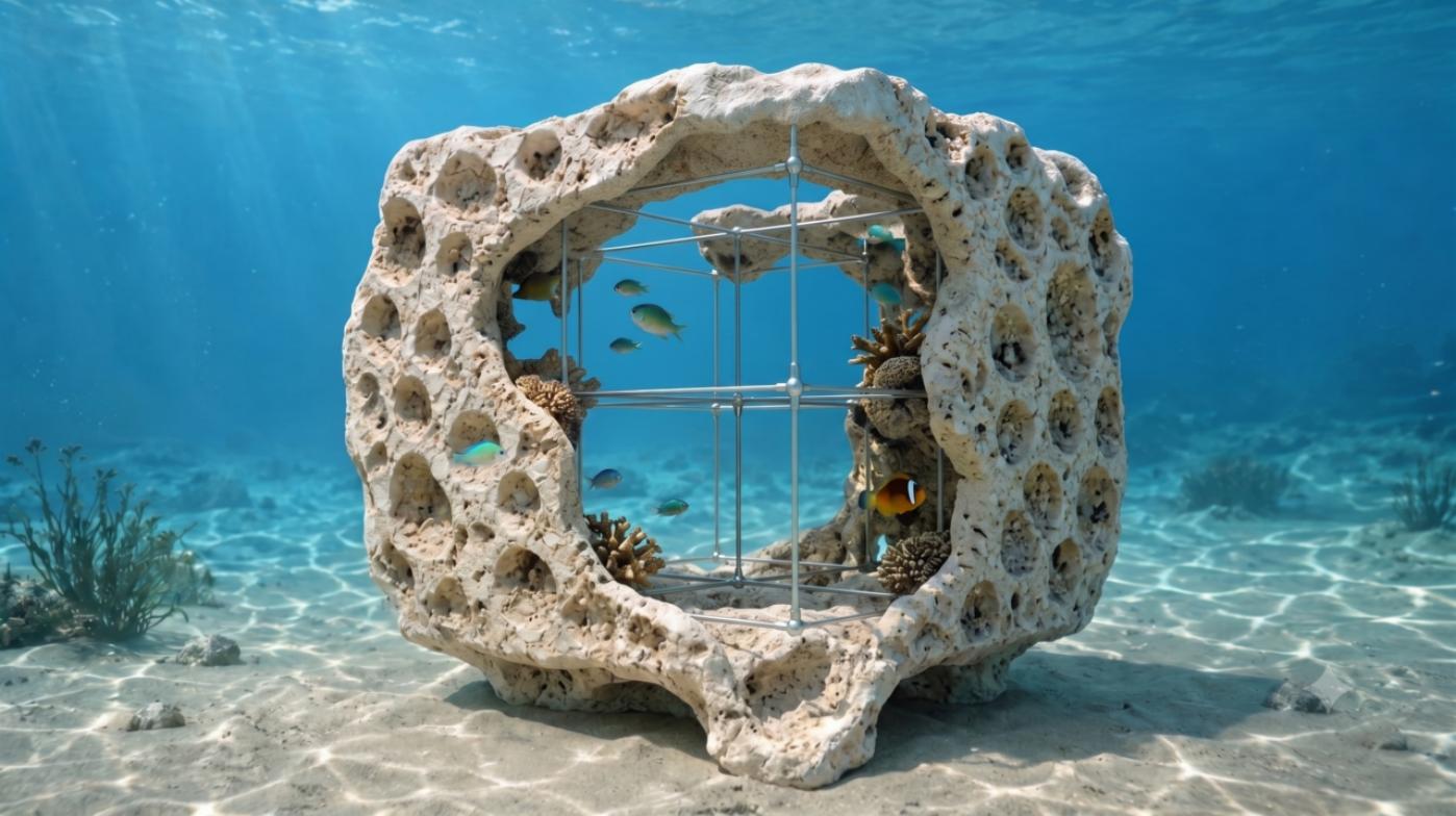
Seashell surfaces designed to be studied.
An outer shell of irregular geometry, formed mainly by seashell-conglomerate pieces, with surfaces that are comparable between modules.
These forms make it possible to study natural colonisation by biofilm, encrusting organisms and local marine fauna. The ecological function is not taken for granted.
Differential contribution
A geo-referenced virtual map of the seabed.
Data does not remain scattered across isolated reports: it is organised into a visual, traceable tool that supports technical interpretation and institutional communication.
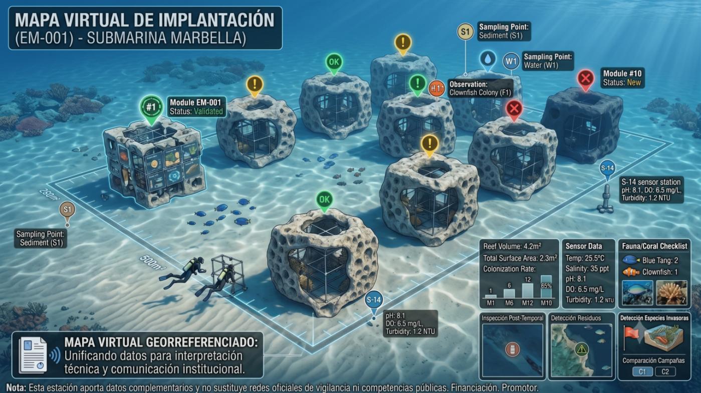 Interactive tool · in development
- Seabed morphology and bathymetry
- Nature of the substrate
- Module positions
- Sampling points
- Species observations
- Colonisation over time
- Presence of invasive species
- Comparison between campaigns
Blue economy and skilled employment
Low physical footprint. High technical intensity.
The economic contribution is not based on occupying large areas, but on generating specialised, controlled and reversible activity linked to knowledge of the marine environment.
- Marine engineering
- Marine biology
- Oceanography
- Professional diving
- ROV and underwater inspection
- Materials manufacturing
- Sensors
- Cartography
- Water and sediment analysis
- Maritime safety
- Environmental data and traceability
- Port logistics
Reversibility and safety
Everything installed can be removed.
Modules, supports, sensors, cables, cameras and cells are removable. At the end of the administrative title —or earlier, if required by the Authorities or if incompatibility is detected— full removal and a final seabed inspection are carried out.
The station will be designed to avoid interference with bathing areas, navigation channels, port accesses, anchorages, recreational diving areas, underwater infrastructure and protected spaces.
Project status
Preliminary stage, prior to the formal administrative application.
Already available
- Consolidated technical report and preliminary configuration
- Environmental surveillance, installation, maintenance and removal plans
- Auxiliary wine-traceability programme
- Virtual map proposal
Pending before installation
- Final selection of coordinates and bathymetry
- Bionomic study and geo-referenced underwater video
- Water and sediment characterisation; absence of seagrass
- Sectoral reports and compatibility with navigation and fishing
- Final technical project and favourable administrative resolution
Institutional contact
A proposal open to observations.
At this stage no installation authorisation is requested. Municipal, environmental, port and coastal departments are invited to learn about the project, point out local constraints and assess the interest of receiving data and reports.
Promoter · Bodegas Verónica, S.L.U.